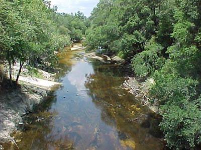
Alapaha River Fishing Spot
- Elevation: 89'
- Last Modified By: vinny60 on 09/07/09 11:31 AM
- Ask about Alapaha River in our Fishing Forums
Photos
Fish Species
Comments
-
Have you fished at Alapaha River? Be the first to comment on this fishing spot.
Alapaha River Description
The Alapaha River is a river, 190 mi (306 km) long, in southern Georgia and northern Florida in the United States. It is a tributary of the Suwannee River, which flows to the Gulf of Mexico.The Alapaha River rises in southeastern Dooly County, Georgia, and flows generally southeastwardly through or along the boundaries of Crisp, Wilcox, Turner, Ben Hill, Irwin, Tift, Berrien, Atkinson, Lanier, Lowndes and Echols Counties in Georgia, and Hamilton County in Florida, where it flows into the Suwannee River 10 mi (16 km) southwest of Jasper. Along its course it passes the Georgia towns of Rebecca, Alapaha, Willacoochee and Statenville. Near Willacoochee, Georgia, the Alapaha collects the Willacoochee River. In Florida, it collects the Alapahoochee River and the short Little Alapaha River, which rises in Echols County, Georgia, and flows southwestward.
The Alapaha River (pronounced /??læp?h??/) is a river, 190 mi (306 km) long, in southern Georgia and northern Florida in the United States. It is a tributary of the Suwannee River, which flows to the Gulf of Mexico.